Download
White Keyboard For Androidr
1.279.1.96 January 22, 2026- 8.5
- 1
- 2
- 3
- 4
- 5

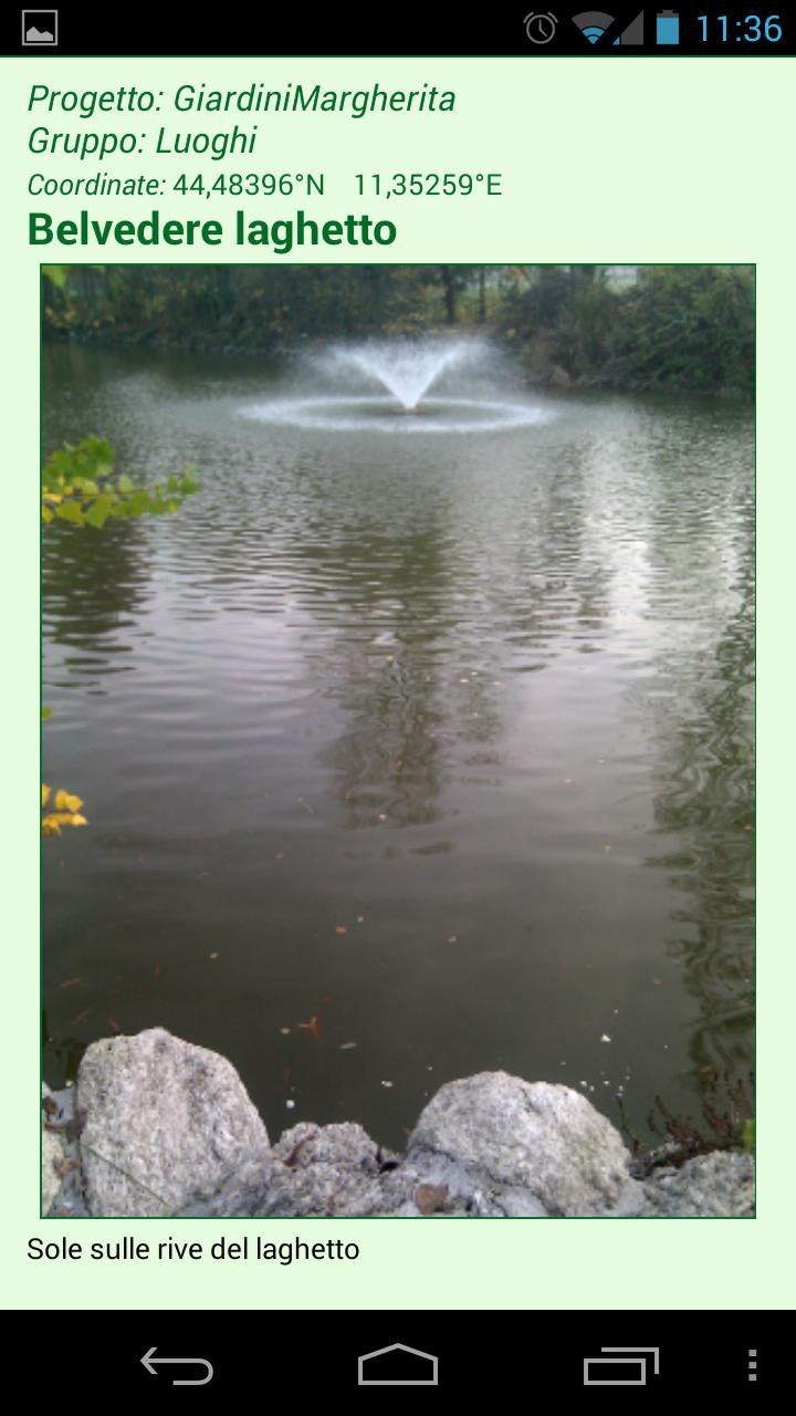
App Coordinates from GPS, MAP OR MANUAL INPUT AND CARS WITH Notes and Photos
Not only GPS for the " Gps Natura " app proposed by UBN - Naturalist Bolognese Union http://www.naturalisti-ubn.it - to all nature lovers in order to record, report and meet significant aspects of the territory that surrounds them and also trace their own paths, record them and obtain a statistics .
Functions
• Possibility to move the app on SD card
• Fast location
• Geolocation with GPS
• Choice of GPS accuracy
• Geolocation from the map
• location by entering the geographical coordinates
• View of the location corresponding to the coordinates
• Adding photos to geolocation
• storage of the coordinates together with description and photos
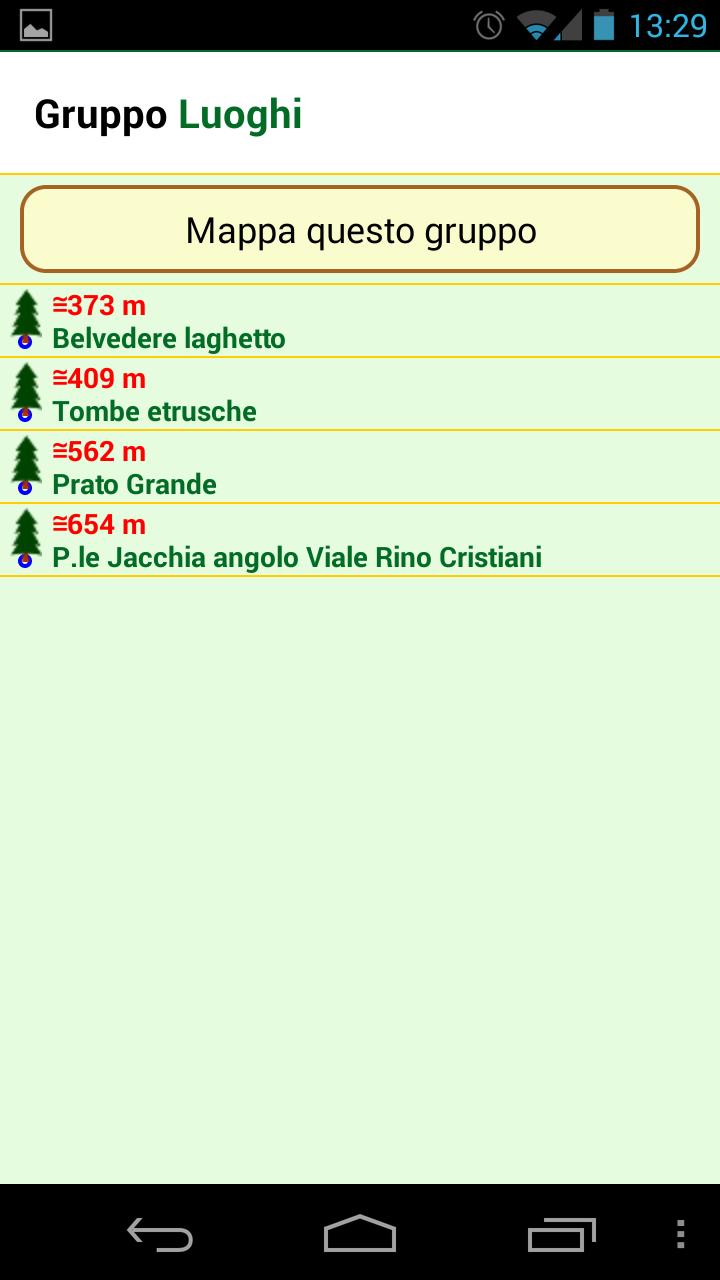
• cards grouped in an archive for projects and groups
• numerous icons available, such as tree, garden, mushroom, butterfly, insect, fossil, mineral and others
• Reporting of the coordinates with email, attaching photos and map
• Management of the archive with the improvement of the coordinates via the map
• Moving the Archive on SD card
• Search and display of cards with description and photos
• View listing cards or map with icons and color code
• Complete projects that can be exportable as files and attaching to an email
• Complete projects importable by other smartphones or reimpractable for backup/restore functionality
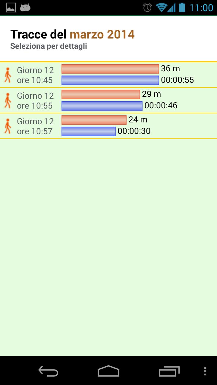
• Tracking of routes with GPS
• Statistics on the paths carried out
• Collection of data on routes: distance, walking time, parking time, speed, starting coordinates and arrival
• Possibility to add a title and description to the routes in a following time
• option to automatically detect stops during the routes, based on the position or movement
• Optional map of the individual paths that can be archived together with the other data
• BUSSOLA with bubble, front and side inclination, exposure to winds
• Choice of the type of compass
• sunshine with dawn, sunset, hours of light and apparent path of the sun
• Import and export of archives (upon agreement with manager)
• guide to the use of the application with examples of use
Possible uses
• botany, mycology, entomology, paleontology, geology
• Study of trees, shrubs and herbs
• Giardini project
• Search for mushrooms
• Fishing diary
• Travel diary
• diary of paths or walks
Characteristics
The location , as well as with the GPS , can be carried out by means of the map or manually enter the coordinates.
After identifying a position, it is possible to create a card and also communicate what is found, accompanying everything with the map and a photo.
The cards created can be deleted or modified and the coordinates can be defined with greater precision.
All cards are structured in a project consisting of homogeneous groups and can be listed or shown on a map that makes navigation possible.
Currently, two projects already built can be imported - as an example, as well as possible, in accordance with those who manage the application, export their own projects.
The aim is to create shared navigation maps, allowing all interested parties to specific naturalistic issues.
The app completes a compass and data on the sunshine for every place and every day of the year.
In addition to the evaluation and review, a detailed report of any problems is welcome by sending an email to the author, so that they can reach their rapid solution.