Download
Safari guide (Kenya)r
2.0 January 22, 2026- 9.1
- 1
- 2
- 3
- 4
- 5

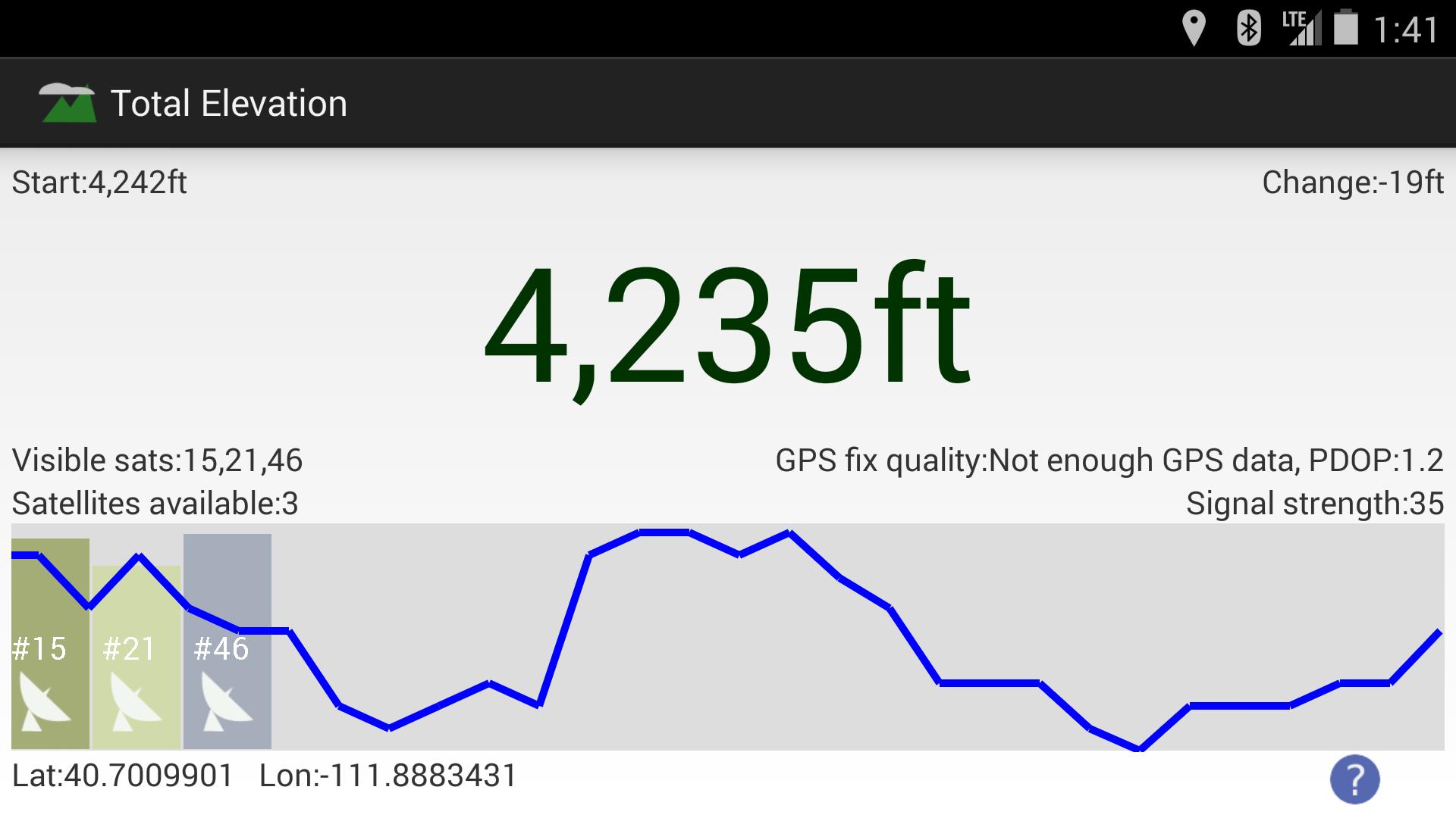
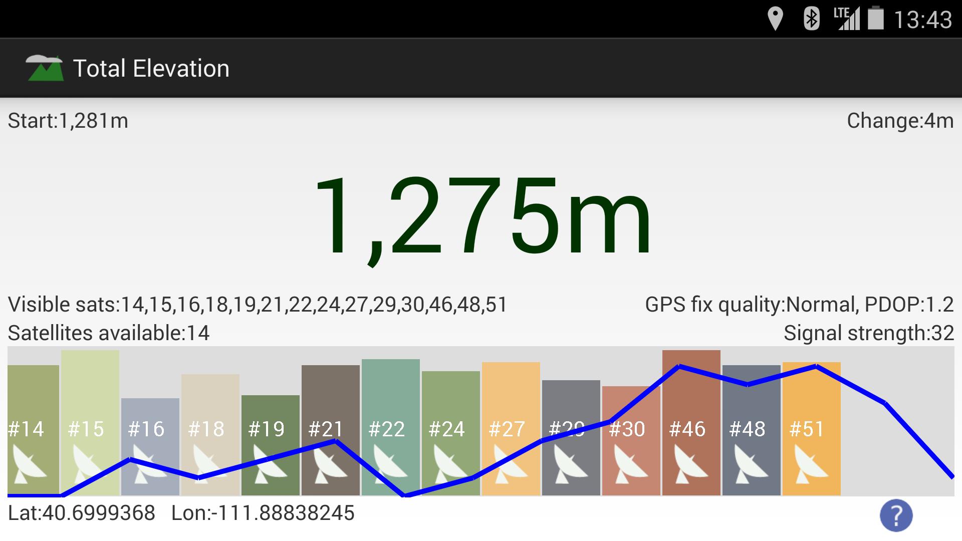
Track elevation & satellites visually.
Track your elevation via GPS. See indicators of how many satellites are visible, and what their signal strength is. A graph shows how your elevation has changed over time.
Easy to use.
No ads.
No special permissions to run besides GPS location (to get the elevation).